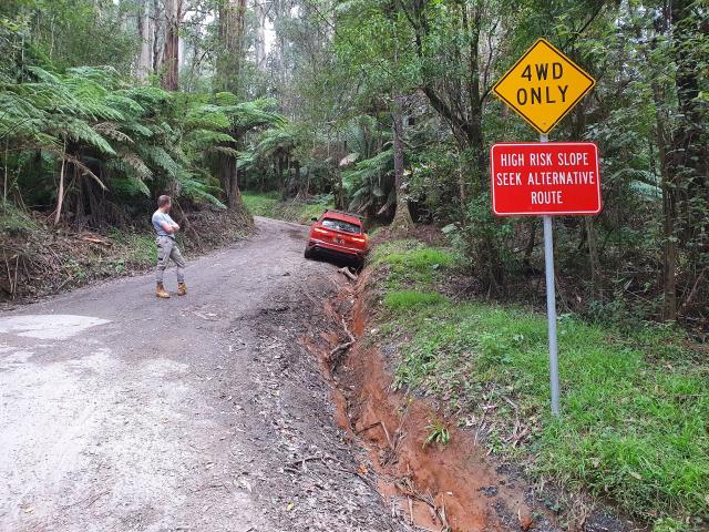
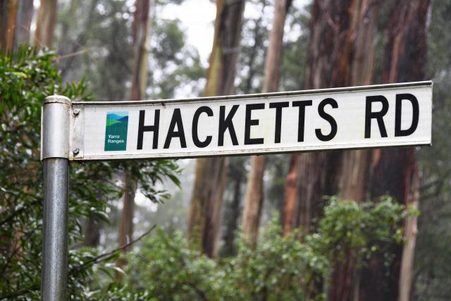
On Saturday 11 June at about 4:30pm, UberEats driver Shiva Kankala took the turn from Perrins Creek Road onto Hacketts Road after being directed to do so by his maps.
But without forewarning and a lack of familiarity with the area, Shiva was unaware his all-wheel drive would be no match for the road’s steep and unstable incline; with his wheels losing traction and his Subaru heading downhill while he tried to accelerate.
“When [I was] hitting the acceleration, I [went] backwards, not forwards, so I ended up going into a pitfall,” Shiva said.
“When I was going back [I thought] I would have fallen to the mountain”.
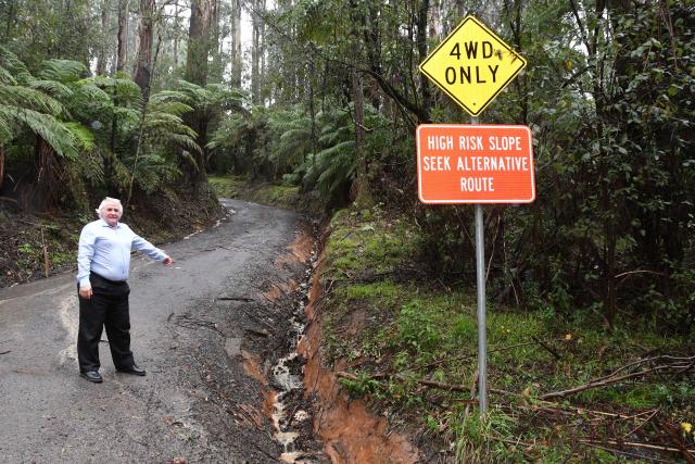
Nearby resident Bill Pizzey said he has witnessed between six and eight similar instances of cars rolling and being stopped by the ditch on Hacketts Road over the past three years.
“[Drivers] get up to the point of going round the tree, and they’ll slide [20 or 30 metres] from there; some of them getting further than others, before they fall in the gutter,” Bill said.
“I know that talking to the tow truck driver he’s pulled out quite a few…there’s probably a few more than we know of.”
He is calling for both Google Maps and Uber to remove the Perrins Creek Road entrance to Hacketts Road, and send drivers through to the Olinda-Monbulk Road entrance as a suggested route to avoid future incidents – but has not yet received a response from either organisation.
“From the point of view of telling Google Maps…to effectively cut the road in half so there’s an east and a west end, and force their mapping program to send you around the other way,” Bill suggests.
This plea follows not just the incident on 11 June, but another on 28 May also involving a delivery driver and the installation of a sign reading ‘HIGH RISK SLOPE – SEEK ALTERNATIVE ROUTE’ by Yarra Ranges Council 18 months ago.
“We’ve been working with community members on Hacketts Road in Olinda to better manage through-traffic,” Director of Environment and Infrastructure at Yarra Ranges Council Mark Varmalis said.
“It appears the road offers a shortcut when travelling through the Hills. Unfortunately, the mapping does not represent the difficult terrain and high risk slope on Hacketts Road, which is very challenging without a four-wheel-drive in sections.”
Community members and Council staff have also been sending feedback to map providers like Google, advising them that the road is not a suitable route for many visitors.”
Shiva had to pay a $400 towing fee to continue driving through the evening and wishes the customer would have left a note to warn him of the terrain.
“We strongly encourage everyone driving through the area – whether you’re a community member or a visitor – to pay close attention to road signs on your journey, so you can have an easy and safe experience and avoid potential accidents,” the Director of Environment Infrastructure said.
In a response to the Star Mail’s request for comment on Tuesday 14 June, Uber said they had not been made aware of the incident.


