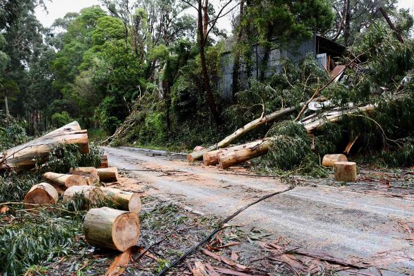
A Dandenong Ranges based weather forecaster has attributed an “unusual” wind direction to the high-levels of destruction occurring across the Hills overnight on Wednesday 9 June.
Bureau of Meteorology forecaster, Stewart Coombs said winds of “at least 120km/h” contributed to the extensive damage that saw trees flatten houses and vehicles, leaving many people trapped requiring rescue.
“The combination of the unusual wind direction, intense wind speeds with gusts reaching at least 120 km/hr in some places and heavy rainfall loosening the roots of trees caused widespread damage to trees. Unused to the wind direction, many trees were exposed to winds at speeds they were unused to and their root systems and structures weren’t set up to cope with,” Mr Coombs explained.
Mr Coombs said trees in the Dandenong Ranges are “used to northerly and westerly winds”, with the wind travelling from the south to southeast exposing many trees that are normally sheltered from intense winds.
“A deep low pressure system developed quickly over the eastern Bass Strait between Tuesday (8 June) and Wednesday (9 June). This low moved northwest across eastern Victoria and very strong south to southwest winds were directed across the Dandenong Ranges, Yarra Ranges and central ranges of Victoria as a result,” Mr Coombs said.
Trees were pushed by the winds in a direction they were not used to, resulting in their root systems struggling to hold tight during the windstorm.
“The results were the widespread damage which we have experienced,” Mr Coombs said.
The Bureau of Meteorology (BoM) issued warnings on Tuesday 8 June that “damaging winds and heavy rainfall” would lash parts of the state as an east coast low was brewing off the east Gippsland coast.
According to the BoM, the bout of wild weather was brought about by two different low pressure systems in the southern NSW region, with warnings issued early Wednesday that one of them was set to “rapidly deepen near the east Gippsland coast on Wednesday night”.
The morning after the storm, Emerald SES unit controller Ben Owen told Star News it had been a “full on night”.
“It’s the worst I’ve seen and I’ve been playing this game for the last 17 years,” he said.
As of 9am on Thursday 10 June, Emerald SES had attended 438 calls for help overnight.
“Most of those call outs we couldn’t even get to. We were cutting our way up roads trying to get to houses… we had police and ambulance stuck on the side of the roads with trees either side of them,” he said.
State wide, the SES received over 4,000 calls for help during the wild weather event, and hundreds more in following days as the clean-up continues.
Mr Coombs assured residents that weather had eased, with 1-4mm of rain expected on Tuesday 22 June and light winds returning Wednesday before turning northeast.


